Satellite remote sensing: Operational service for 3 days forecasting
Coastal and marine resources are of vital importance to the national economy. The marine environment contributes substantially to the island’s economy through the rational exploitation of its living resources. The coastal zones attract human settlement, hotel development, tourism, and other associated economic activities.
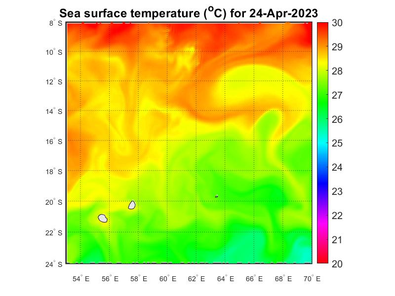
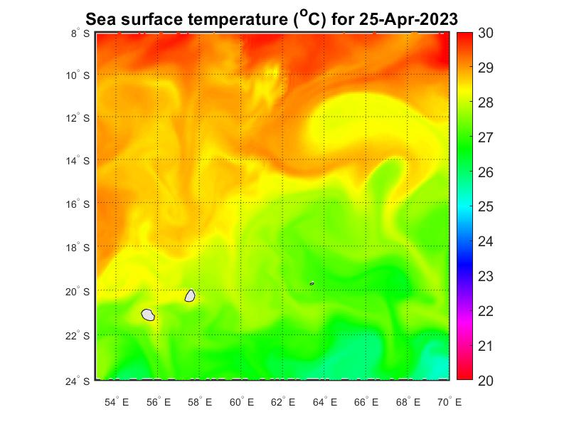
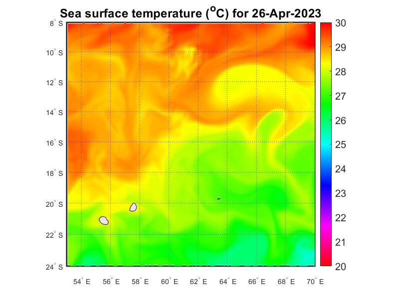
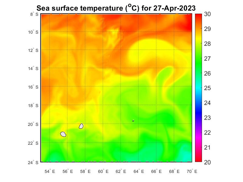
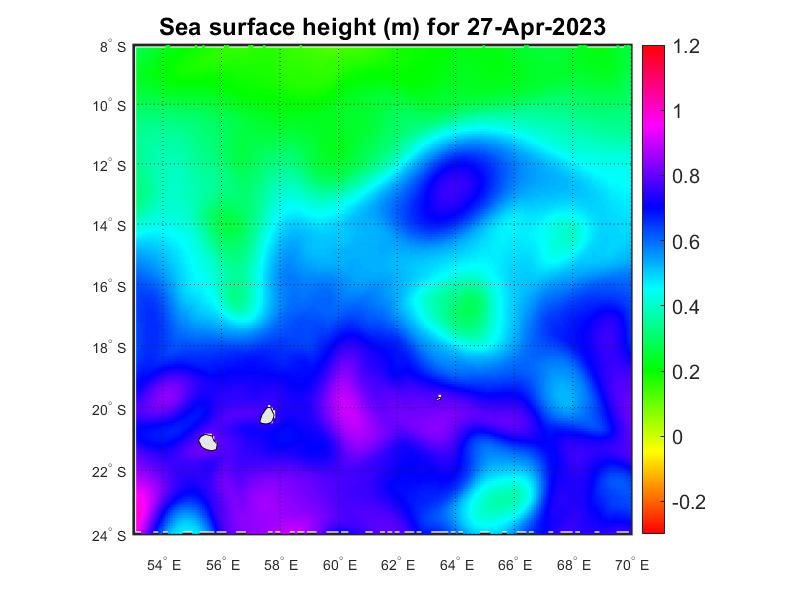
Prior information on the state of the seas surrounding Mauritius is vital for the smooth operational activities for those venturing out into the sea. The satellite remote sensing project focus on the forecasting of oceanographic parameters both surface and subsurface at different scale of time. Data of the oceanographic parameters forecast were retrieved from the Copernicus Marine Environment Monitoring service (CMEMS). The spatial resolution of the forecasted data is 1/12 degree daily frequency. The forecasting parameters that have been developed are:
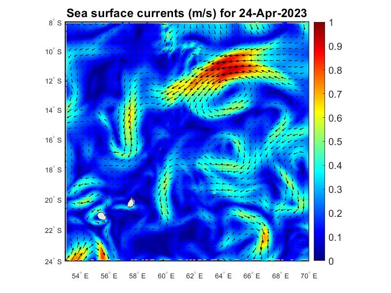
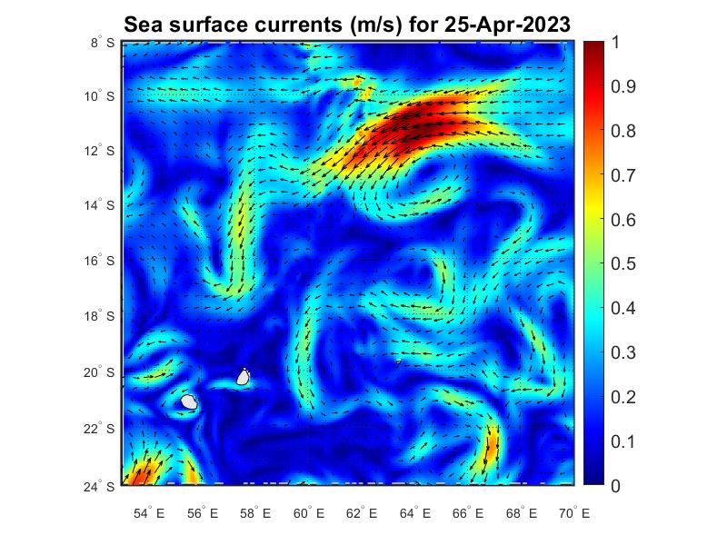
- Sea Surface Current
- Sea Surface Temperature
- Sea Surface Height
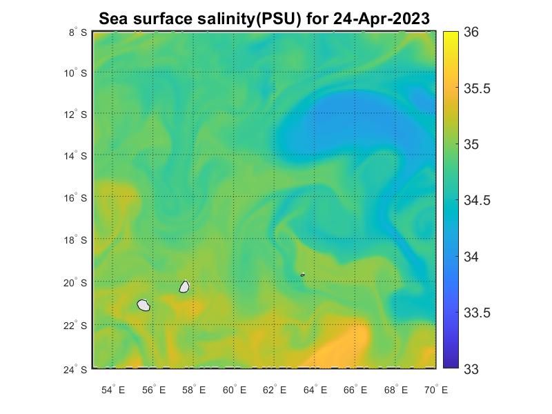
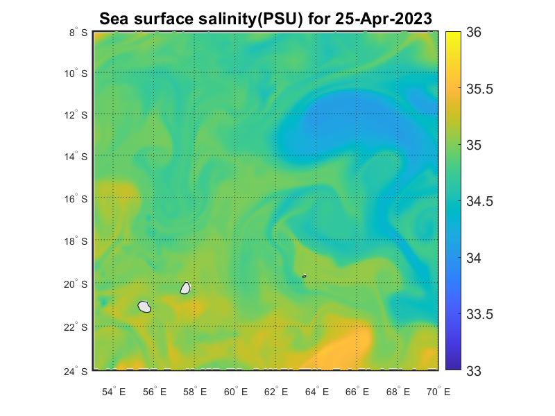
- Sea Surface Salinity
Those oceanographic parameters are extremely important for a wide spectrum of users ranging from fishermen to offshore industries. The forecast of sea state conditions will enable users to take appropriate decisions regarding saving life and property, thus an inherent economic benefit to the users of the ocean state forecast information.
Further, this information is important during contingencies like search and rescue operations in the sea and oil spills. During cyclones and other extreme situations, based on the forecast information, alerts are issued to the general public as well as the administrators of the coastal stretch under risk so that that the population under threat is relocated to safer places.
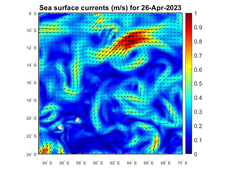
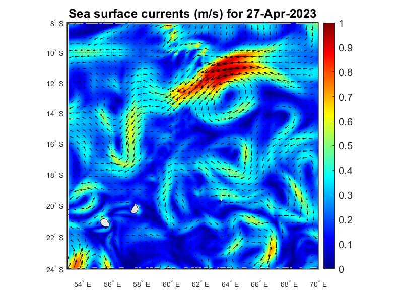
The Color map of sea surface current represents the magnitude of the ocean surface current. Red zones are regions of high current whereas blue zones are region of lower current. The arrows indicate the direction of the ocean current.
Sea Surface Salinity (Nowcast / 1Day Forecast / 2Day Forecast / 3Day Forecast)


Sea Surface Current (Nowcast / 1Day Forecast / 2Day Forecast / 3Day Forecast)
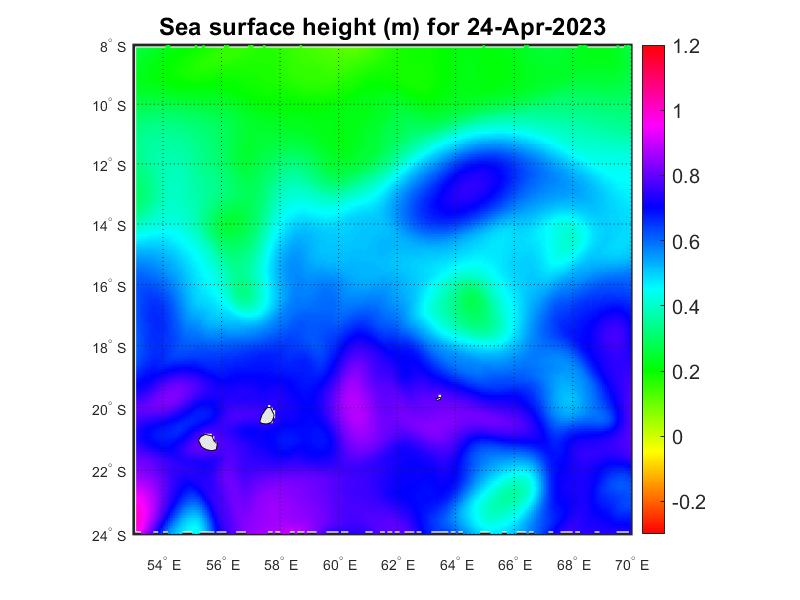
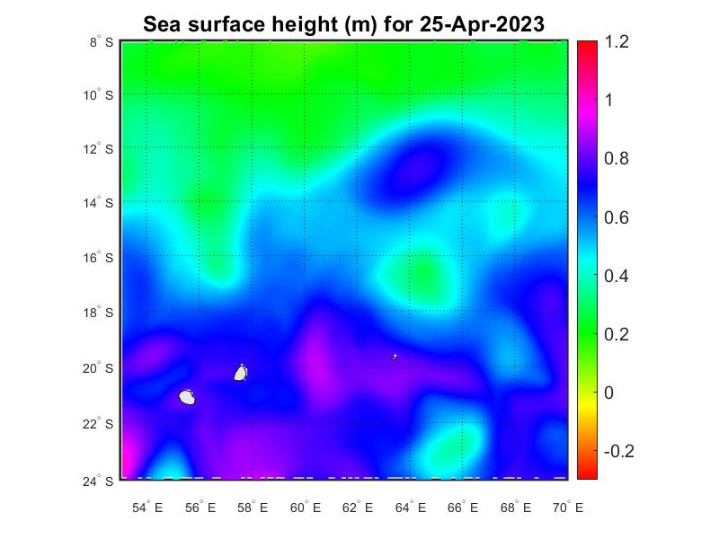
Sea Surface Height (Nowcast / 1Day Forecast / 2Day Forecast / 3Day Forecast)

Sea Surface Temperature (Nowcast / 1Day Forecast / 2Day Forecast / 3Day Forecast)